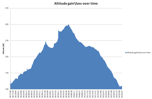
Here is an overview of the walk:
Walk Start Coordinates 52.901157,-6.259443 (Click here for Directions)
gpx file for the track (Click here to Download)
Here is a map of the trail:
The following table shows the stats of the walk:
| Walk Stat | Value |
|---|---|
| Name: | Whaley Abbey |
| Activity type: | trail walking |
| Description: | – |
| Total distance: | 6.29 km (3.9 mi) |
| Total time: | 1:20:21 |
| Moving time: | 1:17:34 |
| Average speed: | 4.70 km/h (2.9 mi/h) |
| Average moving speed: | 4.87 km/h (3.0 mi/h) |
| Max speed:: | 12.45 km/h (7.7 mi/h) |
| Average pace: | 12:46 min/km (20:33 min/mi) |
| Average moving pace: | 12:20 min/km (19:50 min/mi) |
| Fastest pace: | 4:49 min/km (7:45 min/mi) |
| Max elevation: | 318 m (1042 ft) |
| Min elevation: | 129 m (424 ft) |
| Elevation gain: | 198 m (648 ft) |
| Max grade: | 16 % |
| Min grade: | -13 % |
| Calories Burned: |
Info Links
County Wicklow Heritage – Whaley Abbey
History Ireland – Buck Whaley
Pictures and Paintings of hike


Pingback: Final Walk of the season on Thursday, 4th September 2014 | Rathdrum Walkers
Pingback: End of the 2014 Walking Season | Rathdrum Walkers
Pingback: Final Walk of 2015 – Whaley Abbey – 3rd September 2015 | Rathdrum Walkers
Pingback: Thanks to all for a successful 2015 season | Rathdrum Walkers
Pingback: Thursday 29th August – Whaley Abbey | Rathdrum Walkers
Pingback: Thank you for the walks of 2019 and we’ll meet again in 2020 | Rathdrum Walkers